Today several students stayed back from the field to work on assignments and personal projects. Jeff worked on his photo database, field journal, and GIS work on hydrography. Andrea also worked on her photo database and field journal and then marked pottery. Thad continues to work on his research paper while Juan spent the majority of the day marking pottery. I spent the day putting the final touches on my GIS project. Below I have posted the project report.
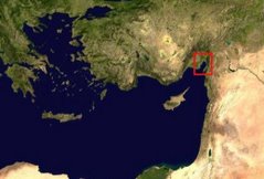
After consultation with Pete I decided to work on a GIS project in the Payas River area. Starting with the Quad maps, contour maps, Corona images, and aerial photographs I determined that the Quad maps and Corona images would be the best sources for my project. The goal of the project is to use the Quad maps and Corona images to create a survey methodology for the Payas River, the proposed location of the Battle of Issus. The best way to prove or disprove the Payas River battlefield thesis is through pedestrian survey with a well-designed methodology.
According to the classical sources the length of the Issus battlefield was 2.4 kilometers from the coast to the foot of the Amanus Mountains. Furthermore, the sources note that Alexander marched from Myiandros to the battlefield in a day and fought the next. There are three major rivers north of Myriandros and southeast of Issus, which scholars have noted as the battlefield site. If one accepts the classical narratives, the battlefield must be within a day’s walking distance from Myriandros and measure (now or in the past) 2.4 kilometers from the coast to the mountains. According to the geomorphologist the Payas River, which today measures 4 kilometers in width, measured 2.4 kilometers in antiquity and was the site for the great battle.
I began my GIS project by georeferencing the Quad maps with the Corona images. This essentially aligned the two images. I then set the Quad maps at 60% transparency so the modern development depicted on the Quad maps could be seen on the Corona images. I then created a feature class where I could draw the current coastline. With the current coastline in place I copied the line and moved it 1.6 kilometers inland so that it would represent a projected ancient coastline. Given the arbitrary nature of the ancient coastline projection I added a 200 meter buffer line on both sides. The GIS map depicts the projected ancient coastline with a buffer zone, modern coastline, modern development that would restrict certain areas to survey, and the Payas River.
Using the measuring tool I determined that the site of Myriandros is approximately 22 miles from the Payas River. The two remaining contenders are further north of the Payas River, which suggests that if the classical sources are correct and the site of Myriandros was correctly identified the Payas River appears to be the most likely site for the infamous battle. To further support the Payas River battlefield theory a survey must be conducted on both sides of the proposed ancient coastline. If the Payas River was the ancient Pinarus there should not be pre-Classical material west of the proposed ancient coastline. If there is material, however, the Payas River cannot have hosted the Battle of Issus.

No comments:
Post a Comment